⚡ Storm or Roof Damage? Get a FREE Estimate
Text ESTIMATE to (844) 907-2546
Or call (800) 792-0212 for 24/7 emergency response
AI-powered • No obligation • Licensed IL & WI
Greetings from Allied Emergency Services! In this unique blog post, we are diving deep into the world of roofing, siding, and window services while exploring a recent 6/29/2023 storm event. Additionally, we will also delve into the awe-inspiring hail size reports for this unforgettable day. Let’s embark on this exciting journey to understand the impact and aftermath of this storm.
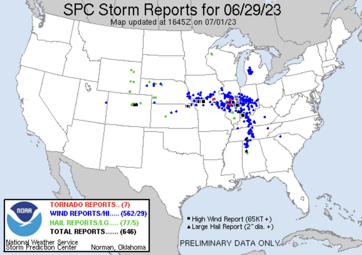
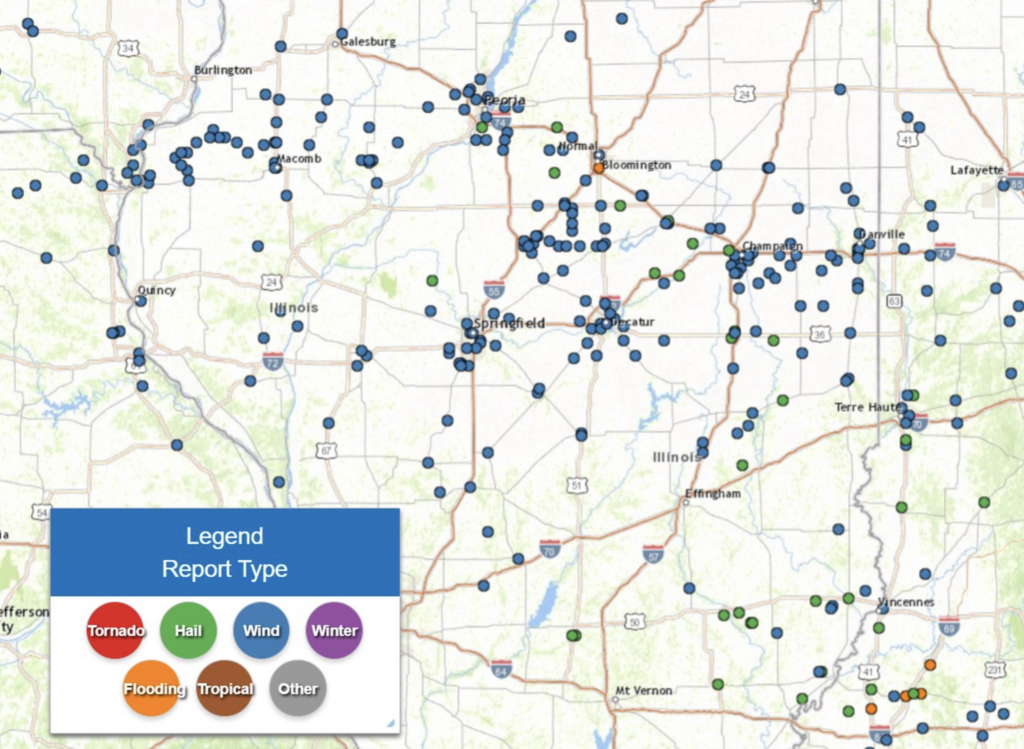
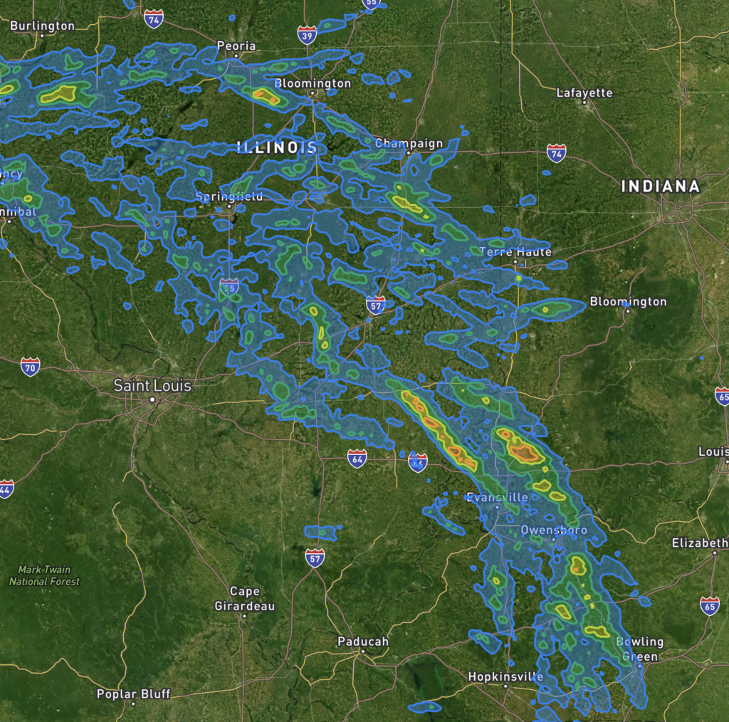
On June 29, 2023, central and southeast Illinois experienced severe weather conditions including a Derecho, significant hail, and tornadoes. The day started with a series of intense storms before sunrise, continuing into the mid-morning hours. These storms were characterized by supercell thunderstorms that produced very large hail and heavy rainfall across the region. Notably, Tuscola reported hail as large as 3.25 inches.
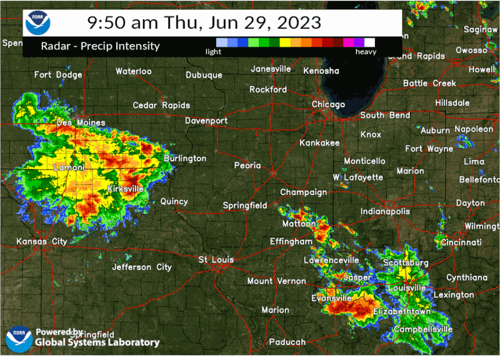
Later in the morning, a large bow echo/derecho system developed from overnight storms in the central Plains and entered west-central Illinois. It then progressed east-southeast, impacting the entire forecast area by late afternoon. The derecho brought widespread and significant straight-line wind damage throughout the region, as well as several reported tornadoes. The extensive wind damage resulted in the downing of numerous trees, damage to crops, and widespread power outages. As the system moved southeast, it continued to produce wind damage in southern Indiana and beyond.
The third and final round of severe storms occurred during the early evening hours, primarily south of I-70. In this area, a few supercell thunderstorms developed and produced large hail, with reports of hail up to 2 inches in parts of Clay and Richland counties.
Now, let’s take a closer look at what a derecho is. A derecho is a type of wind storm that is widespread and long-lived. It is characterized by a band of rapidly moving showers or thunderstorms, also known as bow echoes, squall lines, or quasi-linear convective systems. To be classified as a derecho, the wind damage swath must extend more than 400 miles in length and 60 miles in width. The event should include wind gusts of at least 58 mph (50 kt) or greater along most of its length, with several well-separated gusts of 75 mph (65 kt) or greater.
The Tornado Reports
The storm that struck on 6/29/2023 left a trail of destruction in its wake, with multiple tornadoes being reported in various locations. Here are the details of some of the tornadoes that were documented in the SPC storm report:
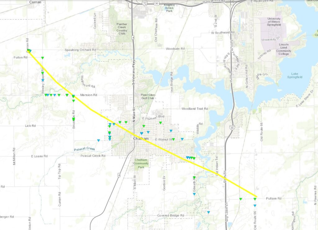
- Tornado in 1 S Curran, Sangamon County, IL (Time: 12:12 pm to 12:19 pm)
- EF Rating: EF2
- Path Length: 9.16 miles
- Maximum Width: 800 yards
- Maximum Wind Speed: 120 mph
- Comments: The tornado’s path extended from 1 mile south of Curran to 2 miles north-northeast of Glenarm. Most of the damage occurred in this area. (Report Source: ILX)
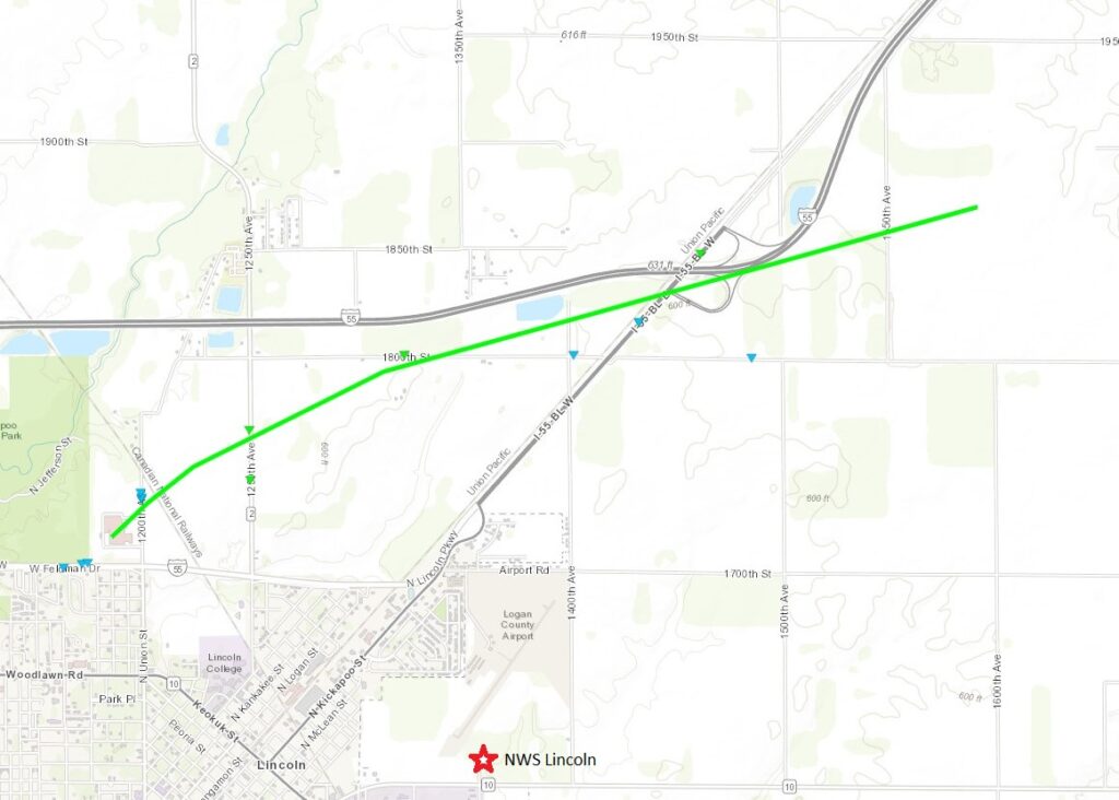
- Tornado in 2 NNW Lincoln, Logan County, IL (Time: 12:26 pm to 12:30 pm)
- EF Rating: EF1
- Path Length: 4.42 miles
- Maximum Width: 800 yards
- Peak Wind Speed: 100 mph
- Comments: This tornado traveled from the north edge of Lincoln to 2 miles south-southwest of Lawndale. The tornado left a significant impact on its path. (Report Source: ILX)
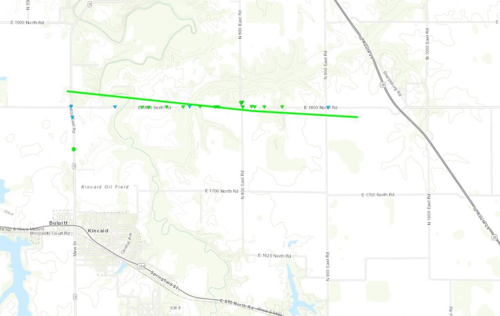
- Tornado in 1 N Bulpitt, Christian County, IL (Time: 12:29 pm to 12:32 pm)
- EF Rating: EF1
- Path Length: 3.46 miles
- Maximum Width: 200 yards
- Maximum Wind Speed: 95 mph
- Comments: The tornado touched down 1 mile north of Bulpitt and continued to 1 mile southwest of Sharpsburg, causing damage along its route. (Report Source: ILX)
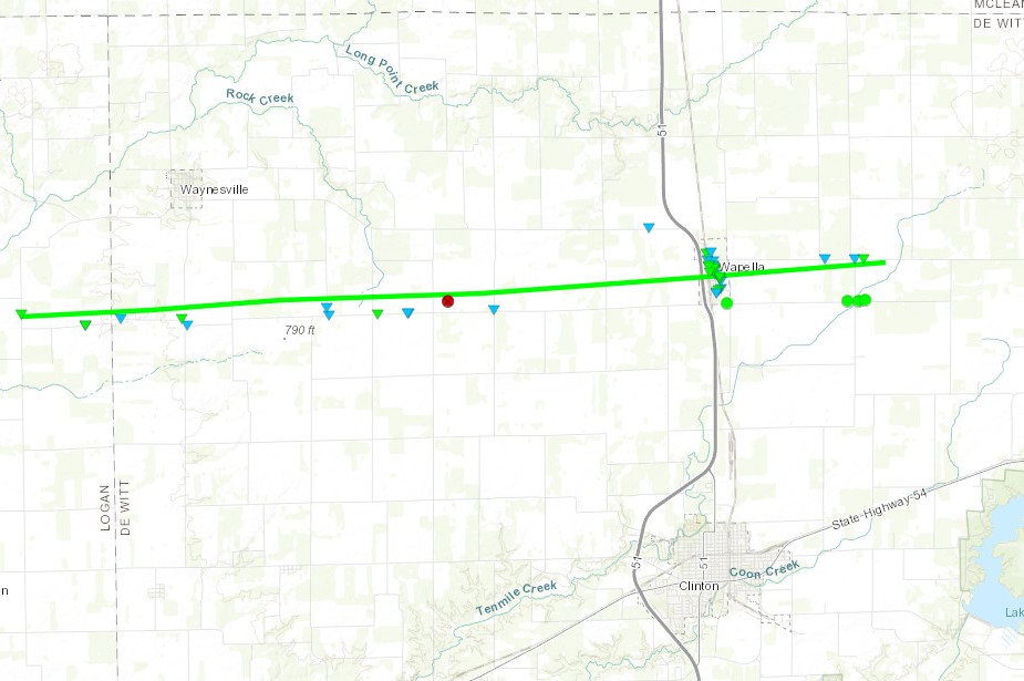
- Tornado in 3 SW Waynesville, Logan County, IL (Time: 12:35 pm to 12:46 pm)
- EF Rating: EF1
- Path Length: 14.2 miles
- Maximum Width: 800 yards
- Maximum Wind Speed: 100 mph
- Comments: This tornado touched down in far eastern Logan County and crossed the border into De Witt County, leaving a significant impact. (Report Source: ILX)
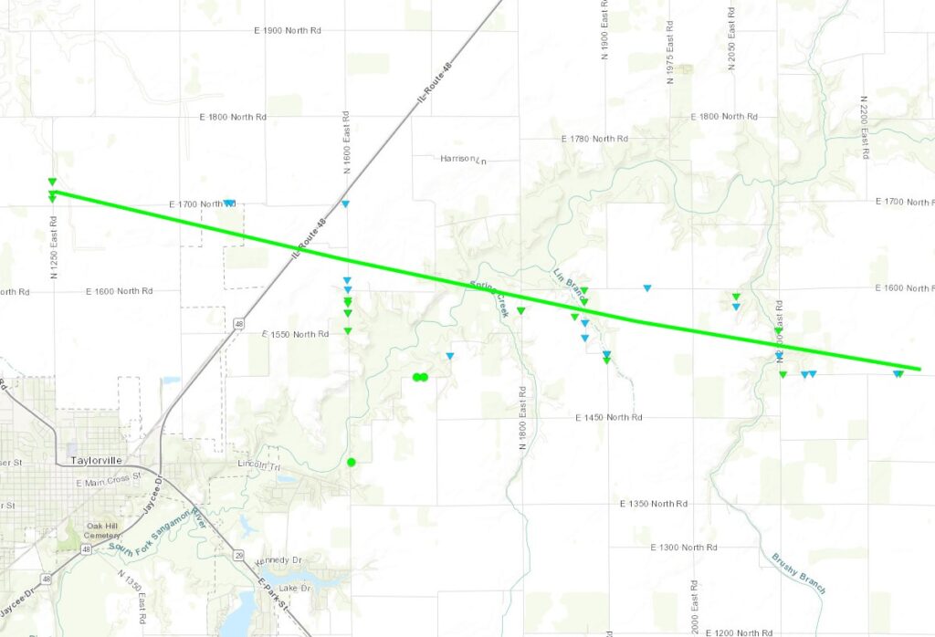
- Tornado in Taylorville, Christian County, IL (Time: 12:38 pm to 12:47 pm)
- EF Rating: EF1
- Path Length: 10.4 miles
- Maximum Width: 200 yards
- Maximum Wind Speed: 100 mph
- Comments: The tornado touched down north of Taylorville, near the intersection of E. 1700 North Rd. and N, causing damage along its path. (Report Source: ILX)
The Unprecedented Hail Size
Apart from the tornadoes, this storm event also brought about an astonishing display of hail. The hail size reports from various locations were truly remarkable. Here are some of the noteworthy hail size reports from 6/29/2023:
- Hail in 1 WSW Ashmore, Coles County, IL (Time: 12:00)
- Hail Size: 1.50 inches (Report Source: ILX)
- Hail in Oakland City, Gibson County, IN (Time: 12:45)
- Hail Size: Ping Pong to Golf Ball sized (Report Source: PAH)
- Hail in 3 SW Noble, Richland County, IL
- Hail Size: 1.75 inches (Report Source: ILX)
- Hail in 5 SSE Noble, Richland County, IL
- Hail Size: 2.00 inches (Report Source: ILX)
These are just a few examples of the hail size reports, showcasing the intensity of the storm and the impact it had on the affected areas.
The SPC storm report from 6/29/2023 provides valuable insights into the devastating tornadoes and remarkable hail size experienced during this unforgettable event. At Allied Emergency Services, we understand the importance of being prepared for such extreme weather conditions. If your roofing, siding, or windows have been affected by the storm, don’t hesitate to reach out to us for professional assistance. Stay safe, stay informed, and remember, Allied Emergency Services has got you covered!
If you have been affected by the recent severe weather in Central and Southeast Illinois and require emergency or restoration services for your roofing, siding, or windows, contact Allied Emergency Services today. Our experienced team is here to assist you and provide the necessary repairs and restoration assistance. Don’t wait until it’s too late, reach out to us now at 1-800-792-0212 and let us help you restore and protect your home.
#AlliedEmergencyServices #RoofingServices #SidingServices #WindowServices #ColesCountyIL #GibsonCountyIL #MenardCounty #SPCStormReport #Tornadoes #HailSize #StormDamage #StaySafe
⚡ Need Storm Damage Help? We Serve 155+ Cities
Allied Emergency Services provides 24/7 emergency restoration across Illinois, Wisconsin, Indiana, and Michigan. Text ESTIMATE to (844) 907-2546 for a free estimate in minutes.
Top service areas: Chicago • Naperville • Aurora • Kankakee • Joliet • Rockford • Schaumburg • Milwaukee • Madison • We’re Hiring!
⚡ Storm or Roof Damage? Get a FREE Estimate
Text ESTIMATE to (844) 907-2546
Or call (800) 792-0212 for 24/7 emergency response
AI-powered • No obligation • Licensed IL & WI
Need storm damage help?
Allied Emergency Services — Licensed IL & WI Storm Damage Specialists
For 27 years, Allied has been restoring storm damage across Illinois and Wisconsin. IICRC-certified, EPA Lead-Safe, IL Licensed Roofing Contractor #104.019029. 24/7 emergency response.
Learn about our Storm Damage service →Free property assessment within 24 hours · No obligation · Insurance claim support